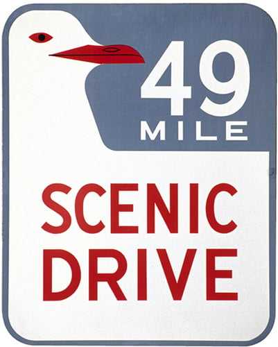
49-Mile Drive This
all-in-one driving tour is marked with blue-and-white seagull markers,
and winds its way through the most picturesque parts of the city. It can
be challenging to follow, keeping an eye out for the markers and the
traffic at the same time, but you can get a map of the route from the
Visitor Information Center .

49-Mile Drive marker
Mount Tamalpais The
road that leads up to the top of “Mount Tam” is appropriately called
Panoramic Highway. All the way along, it provides you with dramatic
views of the Marin Headlands, both on the Bay and ocean sides, and as
you approach the summit, far-reaching views of the Bay Area. Conzelman Road This
road hugs the bluffs, high above the waves, on the southern edge of the
Marin Headlands. It affords some of the most famously beautiful views
of the north tower of Golden Gate Bridge, looking back at the city in
the distance. The way is punctuated with old military bunkers, since
this entire area was once given over to the army to guard the western
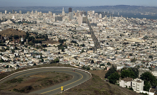
shores. Twin Peaks More
famous panoramas await you here, as you wind your way up the two
mountains. You can get 360-degree views of the city to the east, the
ocean to the west, the Bay to the north, and the valleys to the south .

Twin Peaks
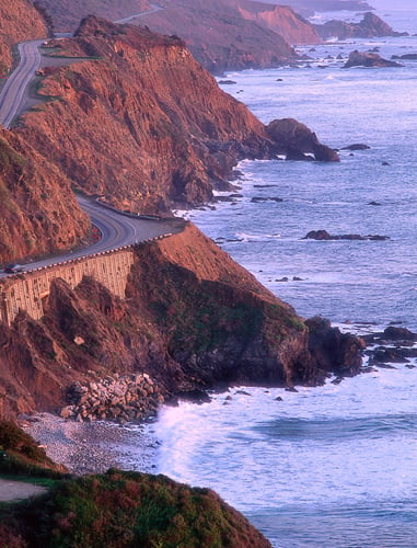
The Great Highway Broad
and straight, this coast highway begins at Cliff House at the northern
end and eventually meets the famous Highway 1, which takes you, via
dramatic cliffs, down to Half Moon Bay, Santa Cruz, Monterey, Carmel,
Big Sur – and eventually, to Mexico.

Highway 1, from The Great Highway
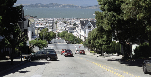
Divisadero This
street cuts a great swathe through the city centre. It starts in the
south at Duboce Street, then rises to glorious mansions and Bay vistas
after Geary Expressway.

Divisadero
Berkeley & Oakland Hills Blending
gently with the Berkeley Hills, the Oakland Hills offer some beautiful
parks, such as Redwood Regional Park. Skyline Boulevard provides access
to most of this ridge area, with many picnic groves and hiking options
along the winding way. Skyline Drive Pick up this bucolic road (Highway 35) at Lake Merced,
and it will take you all the way down the woody spine of the Peninsula
to Santa Cruz. It’s a total immersion in nature, just minutes from the
populated areas around the Bay. La Honda & Old La Honda Roads Behind Stanford University
is the quiet town of Portola Valley. From here, these picturesque
switchback roads ascend to meet Skyline Drive. They are very narrow in
places, and you can’t go more than 10 mph (16 kmph), but the timeless
beauty of the Bay Area forests makes it worthwhile. Highway 9 and Big Basin State Park This
gently mountainous region is almost entirely undeveloped. The main
town, Boulder Creek, is like a small frontier settlement, where
craftspeople sell their wares, and country stores cater mostly to
locals. This is an area that time happily forgot.
Top 10 Hair-raising Hills
Lombard Street Called
“The Crookedest Street in the World,” it isn’t too hair-raising, but
the views of North Beach as you descend are charming. Top of Divisadero The most dramatic section of Divisadero is the highest point in Pacific Heights. Twin Peaks The view from these peaks seems like one from a helicopter, hovering over the city. Gough between Jackson and Washington A hair-raising ascent, especially if your car isn’t automatic – it’s very steep. Sacramento up Nob Hill Take the bus up and hear the engine churning on its painfully slow ascent. Noe at 21st Street At the heights bordering the Castro, Noe Valley, and the Mission, this impossibly steep street will also give you a few chills. Potrero Hill Try Wisconsin Street at 20th for an experience that feels like freefall . Corona Heights Park Hiking trails and some spectacular views. Russian Hill One of the best drives in town, with great views of Fisherman’s Wharf. Filbert Street There’s a sense of flying off into space as you dive over the brink of Hyde and Leavenworth.
|